
The BeiDou Navigation Satellite System (BDS) is currently undergoing a significant upgrade to cater to the increasing demand for high-precision positioning in various industries. The new services offered are designed to deliver decimeter-level accuracy within minutes, which is a substantial improvement over existing capabilities. This enhancement is essential for the development of cutting-edge technologies such as autonomous driving, robotic navigation, and smart city infrastructures, all of which rely heavily on accurate and reliable location data for efficient operations.
Challenges in Existing Systems
Traditional satellite navigation systems like the Global Positioning System (GPS), GLObal NAvigation Satellite System (GLONASS), and Galileo have already set a high standard in the industry. However, limitations such as restricted regional coverage and lengthy convergence times continue to pose challenges. This highlights the necessity for improved navigation satellite systems to meet the growing demands of modern technology.
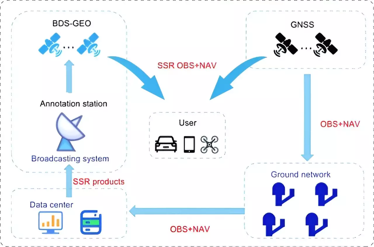
Researchers from the Beijing Institute of Tracking and Telecommunication Technology, the Shanghai Astronomical Observatory, and Wuhan University have recently published a study in the journal Satellite Navigation. The study delves into the high-precision services offered by the BeiDou system, detailing its current status, accomplishments, and future direction. In particular, the study focuses on the PPP-B2b of BDS-3, which achieves decimeter-level accuracy in just 14 minutes.
Despite the progress made, BDS-3 still falls behind global competitors such as Galileo’s High Accuracy Service (HAS) and the Quasi-Zenith Satellite System’s (QZSS’s) Centimeter-Level Augmentation Service (CLAS) in terms of regional coverage and convergence time. To address these shortcomings, the researchers propose a multi-layer development framework that advocates for the integration of low Earth orbit (LEO) satellites. By incorporating a LEO constellation consisting of 288 satellites, positioning accuracy can be improved to less than 5 cm in approximately 1 minute, thereby enhancing global coverage and significantly reducing convergence time.
Advancements in High-Precision Services
Simulation results suggest that LEO-enhanced PPP services can achieve rapid and precise positioning, surpassing current limitations and establishing BeiDou as a frontrunner in high-precision satellite navigation. Dr. Xingxing Li from Wuhan University emphasized the significance of these advancements, stating that the integration of LEO satellites holds great promise in expanding coverage and reducing convergence time. This brings us closer to achieving real-time, centimeter-level positioning accuracy on a worldwide scale.
The improved high-precision services offered by BeiDou have far-reaching implications for a variety of applications, including autonomous driving, unmanned aerial vehicles, and smart device navigation. This progress represents a significant stride forward in the evolution of global navigation satellite systems, solidifying BeiDou’s position as a leader in providing high-precision services for modern technology.
Leave a Reply